Sunday, April 21, 2013

Easy hiking ( / running / cycling) around Stará Boleslav


If you don't like hills like my friend who joined me today, this is paradise for you - there are NO HILLS at all! Which makes the forest to the east (and north) from Stará Boleslav perfect for jogging and cycling, too. We did 14 km but it's easy to make it shorter or longer; it would be very difficult to get lost. Check the map! http://mapy.cz/s/6UL6

There are frequent buses from Prague to station "Brandýs n.L.-St.Bol.,aut.st." from Českomoravská, Vysočanská or Černý most - check in advance. 

I recommend to start (or finish) with visit to amazing local pastry shop Terezčiny domácí dobroty right next to the station (opened Mon-Fri 7-18, Sat-Sun 9-18 (May-September is Sat-Sun 9-19).

 
OK, hiking... :) We followed green up until "Podbrahy" crossroad where we changed to yellow to get back - total distance about 14 km. There are other possibilities where to go - you can also continue and finish at Čelákovice or Lysá nad Labem with frequent train to Prague. The area is forest and don't expect anything special - it's all like you can see on photos. But that still means pleasant stroll! 


Btw. the town itself and even more the Brandýs part across the river is very much worth visiting - but I'll leave details for another post.

Saturday, April 20, 2013

From Beroun to Řevnice - 24 km (or more!)


From Damil
Waterfall in Tetín
View from Tetín castle
Map: http://mapy.cz/s/6U0z We started at Beroun - there are frequent trains from Praha Hlavní nádraží or Smíchov (or buses from Zličín). If you have enough time take a walk in the town - it's very nice - but I'm leaving details for another post.

You can follow the blue mark for most of the trail. First interesting stop is Tetín. Before reaching the village square you can make a detour to the big hill on your right sight - Damil. Besides a perfect view it is a piece of beautiful nature (there used to be a medieval fortress too).
In Tetín itself, some local sights including the castle ruins with perfect view - more about the history at http://en.wikipedia.org/wiki/Tet%C3%ADn_%28Beroun_District%29 . There is a waterfall (15-17 m) under the castle - you can hear the sound of water - just follow it (there is a small but clear path). 

Then the blue trail continues through national natural reserve Koda (with forests, a cave etc.), to village Liteň with a chateau (you cannot see much of it though. You can make a short detour to local Jewish cemetery founded in 1680 - N 49° 53.759 E 014° 08.690) . Next is chateau Svinaře – opened only occassionaly (there will be festival of smithery 1.-2. 6. 2013). 
Altough a big part of the hike is on roads it's still nice because of the landscape views. 

I recommend to stop for a lunch in Halouny in really good pub “U zrzavého paviána”. Look for the signs to follow (some of them say just "Hospoda, občerstvení") or ask - you have to leave the main road to the right... N 49° 53.136 E 014° 12.252. Different menu every day. 

After that, you have to decide for where to continue - our lazy half of the group (including me) took the most direct green trail to Řevnice. Not a bad choice - it's a nice walk in open area with beautiful scenery! If you still have enough energy though, continue on blue trail. Expect quite a few level lines but also perfect hike in forest with a short detour to rock viewpoint Babka. It's also a few km longer.

Trains from Řevnice leave every half an hour Prague.

For geocachers: there are some traditional caches on the way. In Tetin, there is an outstanding multi in English http://coord.info/GC3GMK9 
In Řevnice, don't miss "Spionska" and "Hasici" traditionals.  


Friday, April 12, 2013

From Český Brod to Kostelec n. Č. l. + brewery

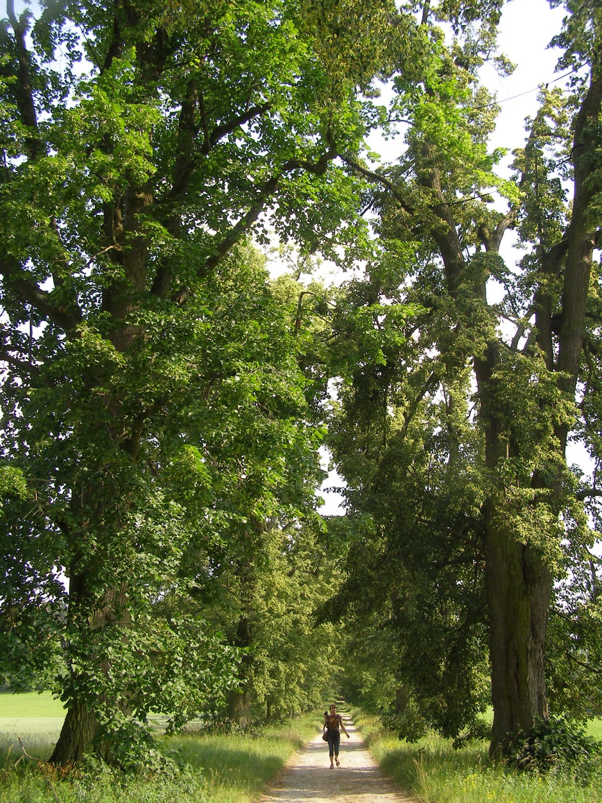
Pleasant spring hike close to Prague. We did 21 km total but that was only because we did a lot of detours. Map: http://mapy.cz/s/6Phd

Trains to Český Brod leave very often (app. every half an hour) from Prague Masarykovo nádraží. If you have Opencard (public transport pass), buy a ticket from the last station in Prague. They are now renovating surroundings of Č. B. station so go to the centre until you reach the red mark. You can stop for some sightseeing (Wikipedia: St. Gothard's Church (baroque church), Gothic bell tower, middle age town wall, neorenaissance town hall, Prokop Veliký monument, renaissance Trinity Church) and also for sweet breakfast (I didn't try personally but it's supposed to be very good - Cukrárna M+Z Kašovi,
nám. Arnošta z Pardubic 39, Mon 10-17, Tue-Fri 8-12.15+13-17, Sat 8-11.30, Sun 11-16). Also there is an outdoor fitness in local parc to burn the calories after and warm up muscles!
(Extra - I also didn't try - but there are some historical underground cellars in "Městské kulturní a informační centrum" (cultural and info centre, + library) at the main square no. 1).

Follow red trail till Tuchoraz with medieval fortress. Unfortunately it is closed for public so you can only see photos to find out how it looks inside: http://hrady.rajce.idnes.cz/Tuchoraz

Now you can change to blue trail (later also to yellow) but we stayed on red until we reached the crossroads and changed to yellow to see the castle Šember ruins - there are none. But it's a nice place:) We went a bit back down the hill and changed to green, heading directly to Sv. Martin church. It is more beautiful though to just stay on red and walk through the river Šembera valley, you reach the church anyway. It is an interesting one to see, built in the end of 12th century. Unfortunately opened only every 4th Sunday in month (11.30) for mass. 

We continued to Kozojedy wanting to take a shortcut to Kostelec but that was really busy road  so I really don't recommend that - instead take the smaller road to the north (http://mapy.cz/s/6Phw) and then red trail again.

In Kostelec nad Černými lesy, you can just take bus to Prague (quite often from the main squary, going to Háje metro). Or go to the brewery pub - although they don't brew (yet) they offer very good special beers, very nice room with collection of first republic beer boards and pretty good food. The service was worse but that is I'm afraid standard in this country:( There is a beer museum, too, now open every Sat. from 3 pm or you can arrange special tour. Website mostly in Czech... http://www.pivovarkostelec.cz/en

There is a beautiful rennaisance chateau, closed to public, but sometimes you can go to courtyard at least.

There is a museum of pottery (I didn't visit) - open Thu-Sat 10-12 + 13-17

Or, take a walk in beautiful vast forest parc which was used by Soviet Red Army as sanatorium (place for healing lung diseases; there are some abandoned buildings too - unaccessible). You can find the entrance on right side of Kutnohorská road at N 49° 59.390 E 014° 51.858.

For geocachers, there is a 100 caches serie "TFTC" with some quite challenging ones - check the favorite points to select the better caches.   

Friday, April 5, 2013

Northwest from Brno and Brněnská přehrada (dam)

Brno is the second largest city in the Czech Republic and writing about it or what to do there would just take too much time, space and after all, everybody is interested in something else. Besides, it wouldn't be much about hiking. Anyway it's definitely worth visiting, and there are great places to go hiking around!

Wiki provides a lot of information: http://en.wikipedia.org/wiki/Brno

In an extremely hot June day 2012, I decided to walk to Brněnská přehrada instead of taking public transport as everyone else. Only one brave friend accompanied me! (Thanks, Tusi:). We started at the bus+tram station Pisárky (but looking at the map now it would been better and more interesting to start already in the southwest from the centre (bus+tram station Nemocnice Milosrdných bratří) where the green trail starts). Even like that, my GPS claims we did 19 km total. Check map at http://mapy.cz/s/6KOW

From Pisárky, take the blue trail up. It's a pleasant walk, opening some nice views. The trail leads you to game park (preserve) Holedná so if you're lucky, you can see some mouflons and fallow deers. There is a whole circle educational trail going around the parc (NS Holedná). At Vrbovec crossroads, turn right, taking first green trail and soon after yellow leading to Bystrc. There you can visit a ZOO. Besides you can visit "Pivo & Beer", beershop with many specials (Vondrákova 2a, Mo-Fr 11-18, Sat 9-13). Eventually the yellow takes you to huge Brněnská přehrada (dam) which is a perfect place to spend a summer day! http://en.wikipedia.org/wiki/Brno_Reservoir

Tip for something I didn't make but I plan for this year - a boat trip! There are supposed to be full information in English but most of it was missing when I visited the page http://www.dpmb.cz/Default.aspx?seo=water-reservoir. Anyway, the boats are going 13. 4. - 13. 10. You can check time of departures here http://www.dpmb.cz/Default.aspx?seo=odjezdy-lodi (left column, first boat is 10.45) as well as list of stations (right column) - you can go to a beautiful castle Veveří (http://en.wikipedia.org/wiki/Veve%C5%99%C3%AD_Castle) or to the final station Veverská Bitýška (70 min, 150 Kč adult one-way, 240 Kč return) and hike back (about 12 km taking the red trail - see map at http://mapy.cz/s/6KON). 

To get back to the centre, take bus or tram from station Přístaviště.


Moravian karst and Blansko

Photo by
Moravian karst certainly deserves much more time than 1 day I spent there! We went for this trip from Brno but actually the nearest bigger town is Blansko. Map: http://mapy.cz/s/6KFZ

There are some good information in English about the whole area: http://www.moravskykras.net/en/moravian-karst.html
There are some good tips for hiking tours: http://www.moravskykras.net/en/nature.html
 
Extra tip: goat farm in village Šošůvka (I didn't visit but I'd like to) where you can buy some cheese etc. - and they have English website! http://www.sedlakkozy.cz/english/index.php It is app. 10 km walk from Macocha following (probably) very beautiful red trail. From Šošůvka, there are some direct buses to Blansko.

Public transport - you can take a bus from Blansko to station "Vilémovice,,Macocha rozc.2.0" - then you have to go a little back and take red trail - check map at http://mapy.cz/s/6KG9 - it is 2 km to the information centre and Macocha abyss (quite impressive look into it). Next to them, there are some possibilities to eat but it's rather dissappointing as is the service of the information centre. 

There are many possibilities what to visit but it's wise to book tickets in advance at info@caves.cz - many weeks in advance for the main season!!!! We did the most visitied tour - Punkevní cave (jeskyně). You go to the bottom of Macocha and you go an amazing boat ride in the caves - highly recommened http://www.moravskykras.net/en/punkva-caves.html. Price is 100-170 Kč adult (depending on the season), tour takes an hour. So there is enough time to visit the other caves too!

After the cave tour, we started the 10 km hike to Blansko, taking green trail (later changes to blue color at "Obůrka rozc.". I almost fall down while looking for a geocache at castle ruins Blansek (not much left there but still worth going). There is an amazing linden alley on the way to Nové Dvory. Right before entering Blansko, you can refresh in an open swimming pool (called Palava). The blue trail finishes at train station "Blansko město".

In Blansko itself, there are some things to see too:
Chateau with local museum and a parc
Building of former local company Adast, built in 1911, copying an Italian chateau in Terst
Baroque church of st. Martin
Wooden church of st. Paraskiva brought to Blansko in 1936 from Carpathian Ruthenia. Beautiful from outside too but it's also opened for public from June to September, every Wednesday and Saturday 14.00 - 17.00.
etc.


Thursday, April 4, 2013

Walk from Lipany to Kouřim and its open air museum

From Prague, take a bus to station "Vitice,Lipany,mohyla" - check for direct buses but you'll probably have to go to Český Brod first. There is a memorial of famous Lipany battle (1434) - read more at http://en.wikipedia.org/wiki/Battle_of_Lipany 
Follow red trail all the way up to Kouřim - it's an easy walk, less than 7 km, through village called Království (= Kingdom) - no idea of whom. There are lot of geocaches around (TFTC serie + some very popular caches in Kouřim). Ideal for winter / early spring (we did it in Dec. 2011). 
http://cernokostelecko.info/wp-content/uploads/2012/04/kourim-img.jpg

In Kouřim, you can spend quite some time sightseeing (historical square, fortification (walls), Jewish cemetary...). There is also astronomical middle of Europe! 

If you have time take yellow trail to educational trail (2,5 km) "NS (naučná stezka) Stará Kouřim" - southeast. Map http://mapy.cz/s/6KeK. First interesting stop is "Lechův kámen" (stone) connected with some legends and beautiful panaroma of the town. Second main point of interest is a former hillfort dating back to years around 4800 B.C. with several settlements during the history. I missed this trail unfortunately but some say the yellow mark dissapers at some parts and goes around the sights. Hope you can find it.

But the main attraction is open air museum (skanzen / muzeum lidových staveb) - collection of old buildings fully equipped to show how people used to live in 17th-19th century. Official website is in Czech only http://www.skanzenkourim.cz.To get there, take green trail from Kouřim square (Komenského and Ruská street, it's less than 1 km).

Opening times: Jan, Feb, March, Nov closed
April, Oct: Fri-Sun, 10:00 - 16:00
May, Jun, Sept: Tue-Sun, 10:00 - 17:00
July, Aug: Tue-Sun, 10:00 - 18:00
Dec (except of 24., 25., 31.): Fri-Sun, 10:00 - 16:00, also opened 26. and 27. 12.
Entrance fee adult - basic 60 Kč, when there is some special programme - 90 Kč

There are some "special days" during the year connected to traditional feasts and handcrafts days during summer - expect special programme, actors in costumes, performance of handcrafts and opened restaurant in the area (tiny but fantastic!). Listed here: http://www.skanzenkourim.cz/pro-navstevniky/narodopisne-porady

To get back to Prague, take train to Pečky and change to another train to Praha, Masarykovo nádraží. Train station is 1 km west from the centre. Or there are some buses going to Český Brod (there you change to a train). 

Nové Město nad Metují + nature trail Peklo

"Peklo" actually means "hell" but that's something you would never think of when visiting these places.

We did this hike the opposite way, starting already in village Borová but that part is not so interesting so I'll just skip that.

Recommended start is in Nové Město nad Metují which is beautiful town worth spending some time at. English website http://english.novemestonm.cz provides good information about history, sights, historical square, accommodation and restaurants as well as some hiking and cycling trails recommendations ("For tourists" chapter)! From Prague, you can get here by bus (2,5 h). We ate at "U Paďourů" at the squary - nothing fancy, classic Czech pub, but the food was great! (and cheap).

The main sight there (besides the historical centre, square and fortification) is a chateau - with a web in English http://www.zameknm.cz/en. Check the opening hours. Entrance fee - 100 Kč adult. Gardens free of charge (very nice! Plus unique collections of caricature dwarfs statues from year 1713). 

You can find a map here: http://mapy.cz/s/6K8Z - so you can see you can easily spend a day there with a short walk for example to a viewpoint and castle ruins (red trail to south-east; Juránkova vyhl. + zříc. hradu Výrov - photogallery at http://www.turistik.cz/cz/kraje/kralovehradecky-kraj/okres-nachod/nove-mesto-nad-metuji/zricenina-vyrov/galerie)

Geocaching - there is a power trail close by - first cache at http://coord.info/GC3NG2E - contact me if you need help with translation


So now the PEKLO TRAIL - THE HELL! I couldn't find out why it has such name:( From the town centre and/or bus station, follow red trail. Most of the time you'll go through a beautiful river Metuje valley; it is a nature reserve. You can even go canoeing on the river! Details here http://rivers.raft.cz/metuje/jaro.aspx?ID=3. After about 6 km you reach crossroads of 8 trails with a confluence of rivers Metuje and Olešenka and restaurant called Bartoňova útulna in a unique old building by architect Jurkovič. Our experience was unfortunately rather bad there (the food). 
Now you have to decide where would you like to continue - check map at http://mapy.cz/s/6Ka2. To go back to NMNM, take yellow (very steep at the beginning) or blue (later green) trail with a stop at Sendraž lookout tower (photos at http://rozhledny.webzdarma.cz/sendraz.htm). OR you can continue to Dobrošov (see another post here about it) and/or to Náchod. From there you can take a bus back to NMNM (15 min) or just stay there, take bus/train to Prague etc. Take blue trail if you want directly to Náchod (7 km) or red if you want to stop at Dobrošov first (5 km).

http://turistika.arkotechnik.cz/Reports/R_023_Peklo/R_023_Peklo_08.jpg

Dobrošov military fortress and surroundings

 Do you like military history of 20th century? You can easily spend a day around this fortress. It was a part of border fortification against Germany built from 1937. There are many military objects spread around the area - check the tourist map at http://mapy.cz/s/6JZq

The main object is accessible in following months and hours. It's closed every Monday! Entrance fee adult 100 Kč. English - only printed information.
  • May-September except Mo 10:00-12:00 13:30-18:00 (with guide)
  • April, October except Mo 10:00-12:00 13:30-16:00 (with guide)
  • year-round all day (groups only by reservation)
There are very good tourist information at http://www.east-bohemia.info/nachod/13_4469_dobrosov-fortress-military-fortifications including tips where to go in the region ("In the surroundings"). And there are many! Nové Město nad Metují, Babiččino údolí, countless nature trails with panoramic views... A lot of topics for next posts!

We got there by car but there are many hiking possibilities around. Perfect start is at Náchod which is a town worth visiting and even staying at for a few days, making it suitable base for exploring the region. Some info here: http://en.wikipedia.org/wiki/N%C3%A1chod. Try local beer Primátor! From Náchod train station, follow red mark up until reaching "Jiráskova chata"; from there yellow or green to the fortress ("pevnost").About 5,5 km total.

Jiráskova chata is quite a unique and beautiful building (built 1921-3 by famous architect Jurkovič). Worth visiting! There is a restaurant... but my experience with it wasn't very good (especially with the service). 

To get back, take a bus to Náchod or walk - take green marked trail for example, and visit some more military sights along the way.


20 km hike Jevany - Mnichovice


Easy and nice hike close to Prague. 

Get a bus from Háje metro station to Jevany (45 minutes). Follow red trail all the way to "Ondřejov - hvězdárna, rozc." - map available at http://mapy.cz/s/6K2g. You will go through national nature reserve "Voděradské bučiny" which is beautiful forest area. You can maybe pick some mushrooms along the way.

From the crossroads, start walking on yellow all the way till Mnichovice. You can stop at the observatory (details http://en.wikipedia.org/wiki/Ond%C5%99ejov_Observatory). 

Consider leaving the yellow mark app. 350 m before "Vlčí halíř rozc." (about 1 km before edge of Mnichovice) and start walking up instead. There is a small not very interesting chateau and mainly an amazing oak which is at least 600 years old (according to a legend 1100! ). Map: http://mapy.cz/s/6JWR or coordinates N 49° 56.167 E 014° 44.486. There is also fantastic geocache http://coord.info/GC3MK96

Before entering Mnichovice, you can stop at http://www.sibenicnivrch.cz - we tried the restaurant, it was quite good. Besides, they claim to be the biggest log house in middle Europe, have lot of sport facilities, ski slope 250 m, and a goat farm. 

From Mnichovice, take a train back to Prague (38 minutes to Main train station / Hlavní nádraží).

20 km Mirošovice - Kamenice + brewery Velké Popovice + chateau Štiřín

This hike is connected to our geocache "Landscape of Baron Ringhoffer" - http://www.geocaching.com/seek/cache_details.aspx?guid=00138a3a-58a6-4afc-85a9-c359dfc0be68 

Classic tourist map: http://www.mapy.cz/s/6JTC 


"The nature trail called Landscape of Baron Ringhoffer has been established in memory of the prominent industrialist who greatly influenced the landscape in the Velke Popovice and Kamenice regions in the 19th century. Baron Frantisek Ringhoffer, the owner of an engineering empire in Smichov in Prague and an important figure in the elite circles at the time, established the brewery in Velke Popovice and a number of other manufacturing enterprises, including a copper mill, saw mill, brickworks and dairy. The Baron and his family took care of the local landscape with great dedication, planting avenues of trees, and maintaining the roads and land surrounding two of their residences – the Stirin, Lojovice and Kamenice chateaus. Their care for the landscape is noticeable to this day.
The tourist trail Landscape of Baron Ringhoffer is one of the greatest walks in the surroundings of Prague. It offers magnificent views of the Velkopopovicko nature park and the surroundings of the Sazava river, an excursion to the Velke Popovice brewery, a stroll through the park belonging to the Stirin chateau, a walk through the avenue of trees leading to the Ringhoffer family crypt, a visit to the church with a rotunda and the Jewish cemetery in Kostelec u Krizku and much more.
The trail is 20 km long, includes 10 information signs and can be reached by the integrated Prague public transport. The walk starts in Mirosovice (on railway line no. 221 – Prague Main Station – Benesov u Prahy) and ends in Kamenice, with transport options including buses to Prague, to the Budejovicka underground station.
This project of the Josef Lada Country micro-region was completed in 2005 – 2006 with a financial support of the Central Bohemia Region."

TRAIL IS SUITABLE FOR CYCLISTS EXCEPT OF SHORT DISTANCE BY REPCICE.
  
Beginning of the trail is to be found next to the train station at Mirosovice. Follow first yellow then blue tourist marked trail and continue until Velke Popovice where you can go to excursion in local brewery or have a great lunch and beer (one of my favourite)! 

Next, follow yellow tourist marks that will lead you to board no. 5. Follow the trail up the hill (across the stream) – this time, first green marks then blue again direction Stirin. Consider visit to the Stirin chateau (you cannot go inside though) and its parc – it is very beautiful! Otherwise continue following blue marked trail to board no. 7 at Hamersky pond. Keep on blue marked trail. Go through a beautiful avenue of trees to Ringhoffers‘ tomb and to 8th board. Still on blue, you will soon reach 9th stop. From there consider a short detour to local Jewish cemetary (photos at http://www.atlasceska.cz/stredocesky-kraj/zidovsky-hrbitov-kostelec-u-krizku)
Unmarked trail will then lead you to the centre of Kamenice and last board at N 49° 54.258 E 014° 35.194 and also to the bus station. Or you can take cycling path or partly green trail - check the map, it's easy. Hope you will like it there!

Geocaching

EVERYTHING ABOUT GEOCACHING: WWW.GEOCACHING.COM

This activity already brought me so much fun, helped me discover so many new places and learn so many new things! Basic membership is for free so all you need is a GPS - which more and more people have in their smartphones anyway. Give it a try. Start with some easy, traditional caches. The more "favourites" it has the more popular and worth going it is. For many people, it is highly addictive activity! :)
For me it is also perfect diversification of the hiking trips, not to mention most caches include interesting facts about places so you can read it when you are there.

Here are lists of my favourite geoocaches ("bookmarks" were here before the system of "favorites" was introduced):


Open air museum in Přerov nad Labem and walk along the river

We did this trip in December 2012.

For only 5,5 km walk we did, start at train station Čelákovice-Jiřina (half an hour from Masarykovo nádraží in Prague centre). Follow green mark. Tourist map: http://www.mapy.cz/s/6JRT. Easy and nice walk along the river. To make the hike longer you can start at Brandýs nad Labem (from there to Čelákovice, follow blue mark until Čelákovice).

You can also add 2,5 km from Přerov n. L. and back following yellow mark to "Přerovská hůra" hill http://en.wikipedia.org/wiki/P%C5%99erovsk%C3%A1_h%C5%AFra

The main attraction in Přerov nad Labem is the open air musem where you can see how our ancestors used to live. Website unfortunately in Czech only http://www.polabskemuzeum.cz/prerov-nad-labem/vystavy. There is a very good photogallery ("fotogalerie") to give you an idea. They have different exhibitions and events during the year following seasons and feasts. Opening hours were (April 2013): Tue-Sun, 9-17, closed for winter. Entrance fee adult 70 Kč.

There is a good restaurant "U skanzenu" very close to the museum.

Further, you can have a look at the chateau from outside.

There is also a "Moto & Velo museum" (I didn't visit). May be interesting though! There are 70 bicycles and 60 motorcycles. http://www.motovelomuzeum.cz

To get back to Prague, better check connections in advance. Mostly you'll have to change (mostly take a bus to Čelákovice and change to a train.